A historic county town with the character of a city
Ipswich so rewards a good walk around it, mixing layers of history with expanses of green spaces and a developing waterfront.
BEST FOR
‘Green Spaces’
| Parks, gardens, squares, cemeteries | Christchurch Park, the Old Cemetery, Alexandra Park, Hollywells Park |
| Rivers, canals, lakes | River Orwell, Round Pond, The Canal in Hollywells Park |
| Seafront | Ipswich Docks |
| Stunning cityscape | Top of Christchurch Park; Alexandra Park |
‘Architectural Inspiration’
| Ancient Buildings & Structures (pre-1740) | Wolsey’s Gate (1533), Unitarian Meeting House (1700), The Ancient House (1567), Christchurch Mansion (1550), Pykenham’s Gatehouse (1471), Ancient house (1567) Blackfriars Monastery (12th C) |
| Georgian (1714-1836) | Ipswich Institute Reading Room & Library (1824) |
| Victorian & Edwardian (1837-1918) | The Old Customs House (1844), Ipswich Town Hall (1878), Ipswich Museum (1890), Old Cemetery Chapels (1855) |
| Industrial Heritage | The Dockyards; Cliff Brewery |
| Modern (post-1918) | The Willis Building (1975), The UCS Waterfront Building (2008) |
‘Fun stuff’
| Great ‘Pit Stops’ | Applaud Café, Tearoom at Christchurch Mansion, Stables Café at Hollywells Park, The Cult Café on the Waterfront |
| Quirky Shopping | ‘The Walk’ |
| Places to visit | Ipswich Museum, Christchurch Mansion |
| Popular annual festivals & events | Ipswich Arts Festival (June/July), Ipswich to Felixstowe Historic Vehicle Run (early May) |
City population: 133,384 (2011 census)
Urban population: 180,000 (2011 census)
Ranking: amongst the half dozen largest in England at the time of the Domesday Book, but not technically a city, so not ranked.
Date of origin: Roman era
‘Type’ of city: Port City
City walkability (www.walkscore.com): 96/100 ‘Walker’s Paradise’
City status: Ipswich remains a ‘town’ despite several attempts at gaining ‘city’ status. (losing out to, amongst other conurbations, Milton Keynes)
Some famous inhabitants: Thomas Wolsey (Cardinal to Henry VIII), Thomas Gainsborough (painter), Alf Ramsay (football manager), Robby Robson (football manager), Nik Kershaw (singer), Richard Ayoade (comedian), Arthur Ransome (children’s writer), Ralph Fiennes (actor), Trevor Nunn (theatre director), Mervyn King (ex-Governor of the Bank of England).
Notable city architects / planners: many different influences, but take a look at this excellent review of Ipswich architecture – http://www.ipswich-waterfront.co.uk/things-to-do-in-ipswich/architecture-visit-ipswich-guide/
Films/TV series shot here: Storage Hunters UK (..can’t find anything else shot here!)
THE CONTEXT
Ipswich is widely accepted as the oldest continuously inhabited town in England. In Roman times, the area around Ipswich formed an important route inland to rural towns and settlements via the River Orwell. The largest Roman villa in Suffolk stood at Castle Hill, 2 miles NW of Christchurch Park.
The modern town took shape in Anglo-Saxon times (7th–8th centuries) around Ipswich Dock. As the coastal states of north-western Europe emerged from the collapse of the Roman Empire, so trading routes were formed with the Kingdom of East Anglia, its early imported wares dating to the time of King Rædwald, supreme ruler of the English (616–624). The famous ship-burial and treasure at Sutton Hoo nearby is probably his grave.
The street plan represented by this early Medieval development still largely survives in the modern town of Ipswich, and is one of the oldest post-Roman street plans to survive anywhere in Europe. Both dock and town have remained in continuous use and occupation ever since.
During Edward III’s reign (1322-1377) Ipswich was one of the richest and most important ports in the country. East Anglian wool was in great demand by the weavers of Flanders and the Netherlands. This prosperity was underpinned by the fact that the town became a major trading post for the Hanseatic League from the 14th to the 17th century.
The town maintained its importance as a port throughout the Victorian era, investing in a wet dock in 1842 that was the biggest enclosed dock in the country at the time. The docks were bombed by German Zeppelins during The First World War, but the greatest damage by far occurred during the German bombing raids of The Second World War.
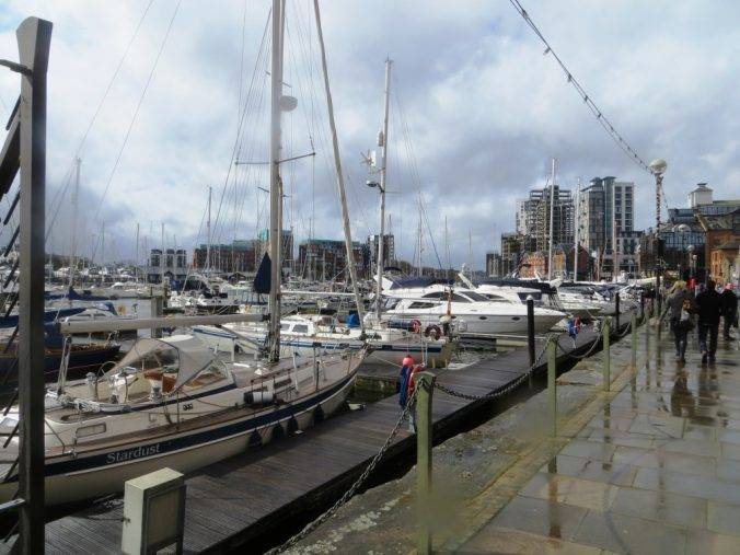
Nevertheless, right through to the 1970s, the docks remained at the heart of Ipswich’s economy. But from that decade onwards they became superseded by Felixstowe, as trade switched to the container business. After a period of decline, the docks were converted to leisure use and also became a base for University Campus Suffolk. The marina has become big business, with over 400 boats moored there, paying £5,000 or so each apiece – a much more lucrative income for Associated British Ports, one imagines, than loading grain.
The River Orwell captured the literary imagination too, as well as being key to Ipswich’ position as a trading port. Being an English graduate, when I hear the word Orwell it always conjures up a writer rather than a river to me; and I kept wondering if there was some connection. Well, it turns out there is. Eric Blair (as he was then known) returned from Paris in 1929 and went directly to his parents’ home in Southwold, which was his base for the next five years. It was felt sensible to use a ‘nom de plume’ for his book Down & Out in Paris and London, published in 1933. The solution was simple – combine the names of the then monarch and a nearby river and – hey presto – you have George Orwell!
And another literary figure is linked to the river too. Arthur Ransome, author of Swallows & Amazons, set the book ‘We Didn’t Mean To Go To Sea’ on the River Orwell estuary, where he moved to. The boat on which it was based, the ‘Nancy Blackett’, was restored in the 1980s by The Nancy Blackett Trust (www.nancyblackett.org) and is moored at Pin Mill just down from Ipswich. The Trust aims to promote sailing among young people. Ellen MacArther, herself inspired by the Swallows & Amazons books (as was all my family) is the Patron. My sister Clare, who certainly did mean to go to sea (and spent over a decade circumnavigating the world with her husband Brian) now has her boat moored in the marina here; and we repaired there at the end of the walk.
THE WALK
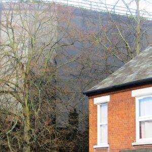
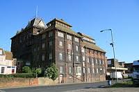
We set out west along the harbour side on a blustery, sunny day of middle spring, a perfect day for walking. This area has a split personality – look one way and it has a modern, hip and happening feel about it. Look the other way and, well, it looks just a little bit run down, with the unfinished hulk of the 23-storey Cranfield Mill building still a blot on the landscape.
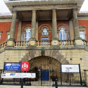
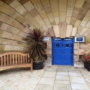
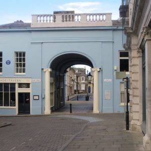
But our eyes are soon diverted by the immediate: a delicious slice of dock history in the shape of The Old Customs House, opened in 1845 shortly after the large wet dock alongside which we are walking had been constructed.
If you like your Victoriana big and bold you will love the Old Customs House. The classical style of the building is particularly impressive from the dockside, with its four columned porticos bearing the Ipswich Coat-of-Arms of lion rampant and the stern of three ships supported by sea-horses, a reminder of the town’s maritime heritage.
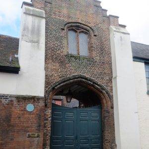
Passing up by the Dance East studios, we crossed a rather unpleasant ring road and spied an old gate as we rushed across the road. Thought I would take a picture of it in case it turned out to be interesting/important. Slight blushes when subsequent research revealed it to be Cardinal Thomas Wolsey’s Gate. Wolsey was born in Ipswich in 1473, the son of a butcher; he went to the Ipswich School, then Oxford, then ordination and eventually became Lord Chancellor to Henry VIII. Not a bad career path…
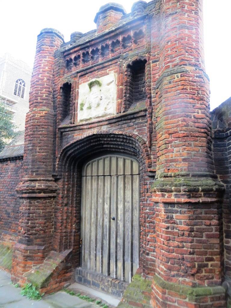
During his years of power he established Cardinal College, Oxford (now Christ Church College). To this institution he wished to add some fifteen feeder colleges in dioceses around England; the main one was to be in Ipswich, his home town. Sort of an early version of the Academy system with wealthy benefactors who have ‘made good’ themselves?!
The college in Ipswich was to be built upon the site of the priory, which was duly dissolved; providing both space and funds toward the building of Wolsey’s proposed school. Building of the college began, including ‘Wolsey’s Gate’ that was only ever supposed to be a small entrance for people arriving by water (the water’s edge used to be here).
But when Wolsey eventually met with his political downfall, it spelled the end for his grand plans for the name of his Cardinal College in Oxford, and the construction of its main feeder college in Ipswich. Now all that remains of the proposed site is Wolsey’s Gate, and it has a rather neglected feel about it.
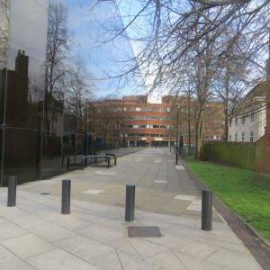
Next we entered the old mediaeval street pattern and headed up towards the town centre. All was looking suitably traditional and quaint, timber-framed houses, wattle & daub, that sort of thing, until suddenly, out of nowhere, we are confronted by one of Britain’s most famous post-war modern buildings, Norman Foster’s Willis Building. Opened in 1975 for the insurance firm Willis Group Holdings, it came to be seen as a landmark in the development of the ‘high tech’ architectural style; and in 1991 it became the youngest building ever to be given Grade I listed building status.
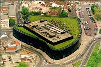
Now, you will have to imagine this, or click on Google Earth, or wait for the next Heritage Open Day, or maybe even get a job there; but one of the things it’s famous for is its rooftop garden, which makes a popular lunch spot on a sunny day for the 1,300 staff. In the words of the late Zaha Hadid, who made a short programme about the building for the BBC (http://www.bbc.co.uk/iplayer/episode/p01rtnkh/building-sights-series-4-7-willis-corroon) , it is “as if you are in a meadow, connected to the other green spaces in the landscape.” There is an acre of space, with top soil and a privet hedge surrounding it, neatly clipped by gardeners.
What we can experience from street level though, is the sinuous glass curtain walls, which though very familiar to us today on so many buildings, were very unusual in the UK at the time. The use of dark glass, a curtain wall and lack of right angle corners mirrors the Art Deco Express Building in Manchester – one of Norman Foster’s favourite buildings (see our Manchester walk). The buildings and people of Ipswich are constantly reflected in the glass walls, a kaleidoscope of activity and interaction, a continuous cinema reel of life in the town, changing in character according to the weather and time of day.
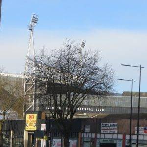
If you look west from here you will see in the distance Ipswich Town Football Club. Two of England’s greatest managers cut their teeth here – Sir Alf Ramsey (who was buried in the Old Cemetery in the town on his death in 1999) and Sir Bobby Robson. Ipswich Town won the League Championship in 1961–62 (their first season as a top division club) during Ramsey’s reign, as well as the 1978 FA Cup and the 1981 UEFA Cup under Robson. I love the lettering of the club’s name on the side of the stadium, very 1970s.
And just when you were looking for a Grade I listed building, two come along at once, albeit of a very different character. Somewhat overshadowed by the Willis Building (but often beautifully reflected in it) is the Grade I listed Unitarian Meeting House (the white building in the picture above). It is one of the finest surviving examples of a purpose-built late seventeenth century Nonconformist church in England. The interior includes many impressive original features, including an elaborately carved pulpit. Norman Foster probably loved the idea that one non-conformist building was next to another!! Both breaking the conventions of the day…
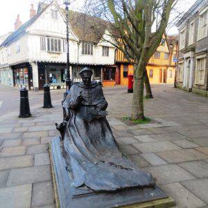
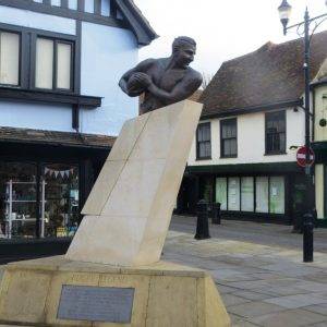
Ipswich likes its statues and it seems to like them contrasting. Earlier, walking up St Peter’s St, we had come across a sculpture of Wolsey, at the junction of Silent Street close to where he lived, in didactic pose with book in hand. Then, in Cromwell Square we had passed one to Prince Obolensky, the naturalised rugby legend from Russia who had scored two tries in his first match against the All Blacks.
And here, wedged between the Unitarian Meeting House and the Willis Building, stands the Millennium Obelisk; the four faces celebrating the Millennium, the 300th anniversary of the Unitarian Meeting House Ipswich, the 25th anniversary of the Willis Building and the 800th anniversary of the town’s first charter.
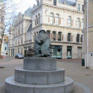
And as we approached the main town square, we came across another statue, of the Giles cartoon characters, with grandma naturally enough the main feature. It sits right outside the newspaper office where Giles worked in the 1930s; and he remained a resident of Ipswich even when he started working for the Daily Express. The statue is well crafted, and Giles would probably be somewhat amused to discover that it is now a favourite spot for the youth of Ipswich to drink, smoke and generally while away the hours.
(If you fancy still more statues and want to take a closer look at the football ground, Sir Alf Ramsay’s statue is on the intersection of Portman Rd and Sir Alf Ramsay Way; and Sir Bobby Robson’s statue is also on Portman Rd).
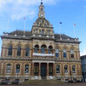
Ipswich Town Hall, built in 1878, is constructed in a grand Victorian style with three figure heads of King Richard I, Cardinal Wolsey and King John decorating the front wall. King Richard I promised the town its first charter but died before it was granted, King John granted the town’s charter and Cardinal Wolsey, well we know about him.
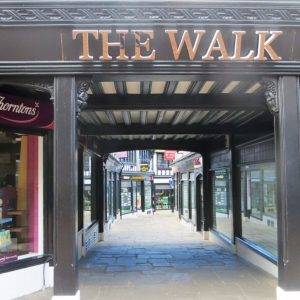
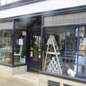
On the right, as we walked east along Tavern St, we peered down ‘The Walk’ shopping area. Being a medieval town, you first think mediaeval passages, but it’s definitely not that! It turns out in fact it was the first shopping mall in Ipswich, constructed in 1938, and some way ahead of its time. Before being redeveloped The Walk had simply been a narrow entrance to the rear of buildings on Tavern Street, not in public use and without an exit. The sheds and workshops at the back of the shops were demolished and replaced by a narrow shopping lane with numerous small retail units. To add to the ambience, many of the buildings were finished in a mock Tudor style with extensively carved timbers. Leslie Barefoot was the architect; as the blue plaque up on the side of one of the buildings attests, he was most famous for being awarded a George Cross for bomb disposal in the Second World War. From ‘The Walk’ to the long walk…
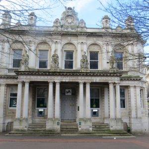
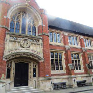
Just opposite at 15 Tavern St (alongside the Body Shop), is the Ipswich Institute Reading Room and Library, founded by Dr George Birkbeck in 1824 with support from several local businessmen, dedicated to making knowledge available to the ‘artisans’ of Ipswich and encouraging their general and vocational education.
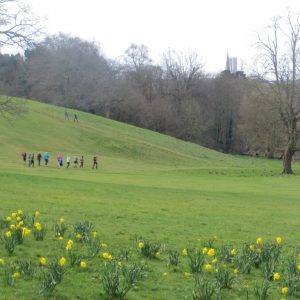
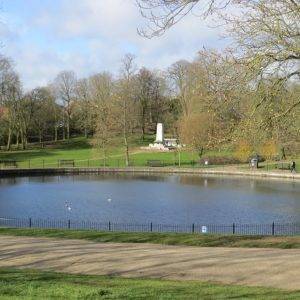
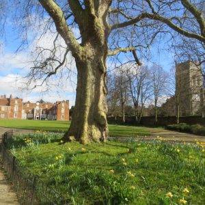
Christchurch Park (28.3 hectares, 70 acres) opened as the town’s first public park in 1895. It’s one of my favourite parks anywhere in the country; its slope down to the town gives it shape and great views. You could spend a lot of time here; and the townsfolk seem to embrace it; running, doing yoga, pushing prams, chatting, sleeping, having a picnic, playing French cricket, reading the newspaper, all the activities of contented daily living in fact.
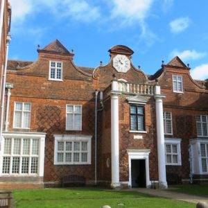
From the 12th century the park was the site of the Augustinian Priory of the Holy Trinity. In 1536 the Priory’s estates were seized by the crown during Henry VIII’s Dissolution of the Monasteries. The land was purchased by a London merchant, Paul Withipoll in 1545, and the priory was demolished and Christchurch Mansion built in its place. The Mansion remains the impressive Tudor centre piece of the park and contains a museum, art gallery and tea room.
By 1772 the public were granted some access to the park and there was a keyholding system for those who would sign an agreement with conditions of entry. The mansion and grounds were eventiually purchased by Felix Cobbold, great local benefactor, and given to the town as a public park and museum in 1895.
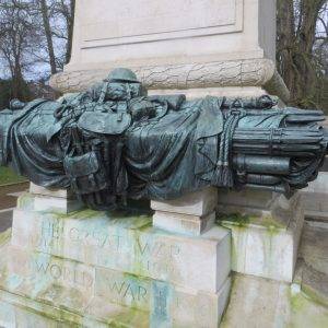
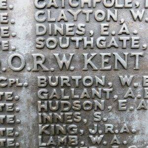
The two War Memorials commemorate the fallen servicemen from the Boer War, The First World War and The Second World War. Amongst many, the name of Lance Corporal WE Burton is recorded here, Brian’s maternal grandfather, who had been a typewriter salesman until he was thrown into the cauldron of the western front and lost his life in 1916.
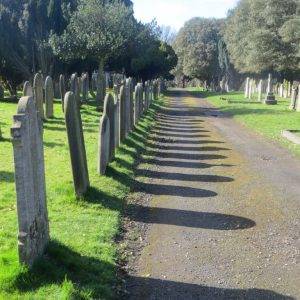
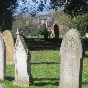
Just east of the park is another one of Ipswich’s ‘rus in urbe’ glories, the Old Cemetery, opened in 1855. A vast, rolling landscape of mainly Victorian graves and buildings, it cuts right down towards the centre of town, and stretches out to the 1930s ring road.
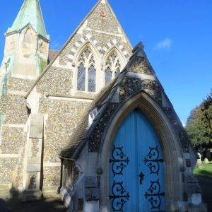
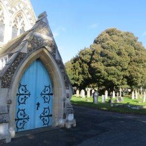
As you head south through the cemetery, pausing to read old inscriptions and also experience the poignancy of more recent burials, you will happen upon two little chapels, dwarfed by the immense spruce tree between them. They appear identical, except that the western chapel has a copper spire; the eastern one doesn’t.
They were built together for the opening of the cemetery by Cooper and Peck. The one with the spire was for Anglican use, the one without for the non-conformists. High Gothic in appearance, traditionally Suffolk in their use of buttressed flint, they are splendid. Inside, encaustic tiles and coloured glass typify their age.
If this is your thing, there are some really amazing pictures of 400 headstones to be found at; https://www.flickr.com/photos/norfolkodyssey/sets/72157626631284876/
And if you wish to pay your respects to Sir Alf Ramsay, the famous football manager, his modest headstone can be found at OC 194 in the Cremation Plot.
After a while we headed back south down Cemetery Rd. Now I’m very seldom given to moaning, especially in print, but I must just mention the ‘bane of the bins’. So many streets in cities are in my view ruined by bins being left semi-permanently outside the front of buildings. Here’s a classic example. Now I have no idea what the answer is, but…

Anyway, moving on…we dropped back down through the east side of Christchurch Park, past the Mansion and through the southern exit into Northgate.
Opposite the fine Ipswich County Library building we spotted Pykenham’s Gatehouse. This Grade I listed building was built in 1471 by William Pykenham, who had been appointed as Archdeacon of Suffolk. Having decided that the house he had rented from the Priory of the Holy Trinity was not fitting for his status, he proceeded to have this gatehouse built on adjoining land. Admire the large brick four-centred arch and the timber-frame with its wattle & daub filling between the studs.
It’s not often that we recommend going into a chain for coffee, but today we make an exception. It turns out Charles Dickens stayed in Ipswich at the Great White Horse Hotel, and used it as a setting for scenes in his novel The Pickwick Papers. He made the hotel famous in chapter XXII, vividly describing the hotel’s meandering corridors and stairs. The building now houses branches of Starbucks and Cotswold Outdoor, but you will see its former name still emblazoned on the side of the building.
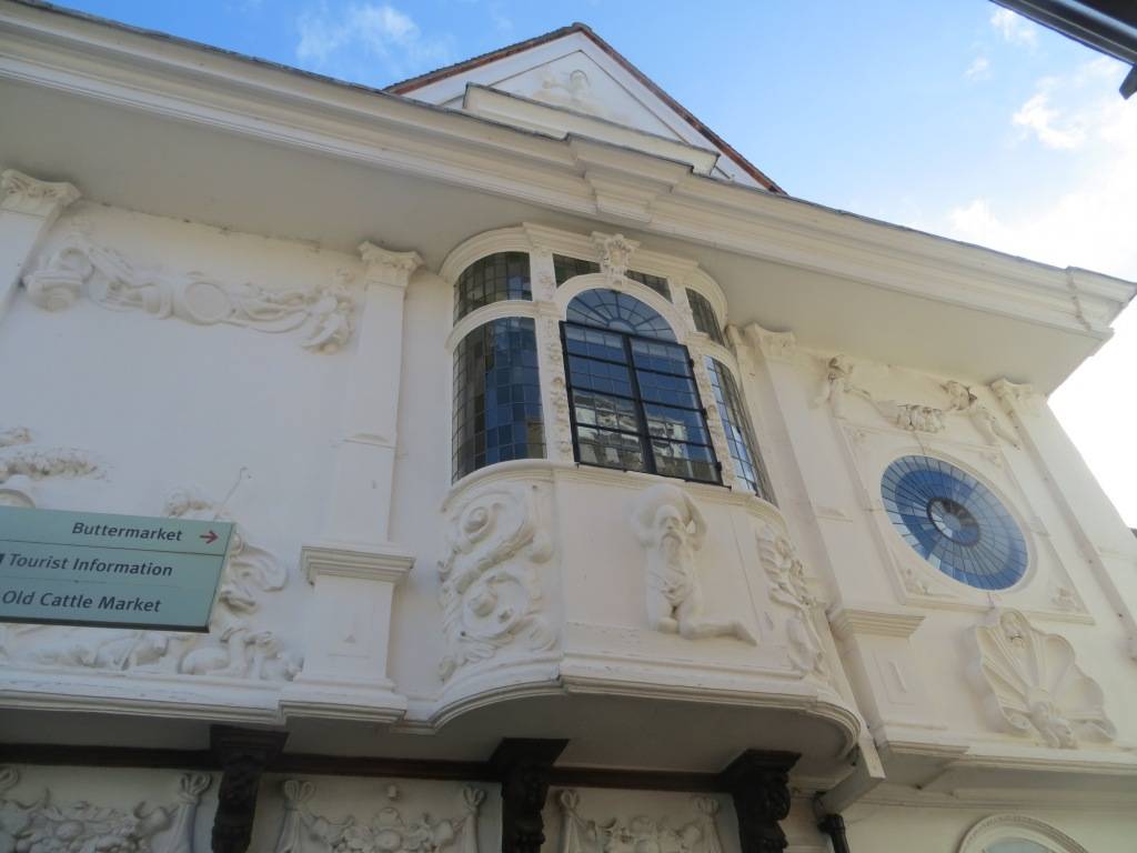
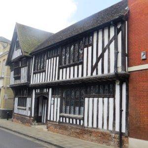
The Ancient House in Buttermarket is one of Ipswich’s most famous buildings. Built in 1567 this Grade I listed building was originally named the ‘Sparrows house’, after the Sparrowe family took ownership in the 1590s, and where it remained for almost 300 years. As staunch royalists, the Sparrowe family made a number of adaptations to the building, which included decorating the exterior walls with extravagant pargetting, with the Royal Arms of King Charles II set proudly in the centre. Four continents are positioned under each window, Europe, Africa, Americas and Asia. Australasia is missing as it was undiscovered at this time.
Five monasteries once stood in Ipswich but none of them survives today. Only the ruins of the Blackfriars Monastery, which we pass by as we head east, give an idea of what these medieval monasteries looked like.
We reached Alexandra Park (5 hectares, 12.4 acres), by cutting through the university buildings to enter by the west gate. The park was officially opened to the public in 1904, purchased from the Byles family’s Hill House Estate. The park has views down to the waterfront and The Orwell Bridge. At the time of our visit, it did not seem nearly as well maintained as Christchurch Park.
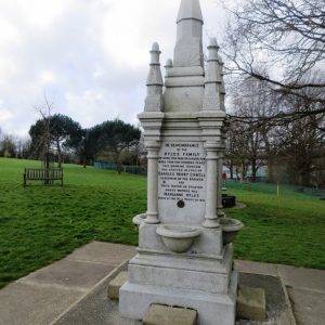
An interesting feature is the drinking fountain, which is a memorial to a member of the Byles family, erected in 1905, but sadly today no longer working. There are stone steps on each side to make it easier for children to reach the water basins, and rather poignantly you can see how they have been worn down by many little feet. Close to a slum area of town, this fountain would have been an important source of fresh water in an era when sanitation was still very poor.
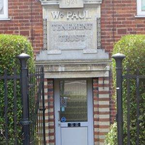
As we came out of the park, we spotted the Wm Paul Tenement trust buildings across the road, built in 1926. A little bit of digging brings this up on William Paul (1850-1928), the benefactor:
“William Fraser Paul was ambitious and forward-looking; a self-made man, he preached the values of personal effort. He valued his long-serving and loyal workforce, ‘my old servants and fellow helpers in business’, and sought to reward them. From an early age, he was active in civic life; a justice of the peace, member of the Ipswich Dock Commission, the Museum and Library Committee and a Trustee of Ipswich Municipal Charities. A staunch Liberal, he served as town councillor (1890-1908), alderman (1909-28) and mayor (1900-1). Notably, during his term of office, he refused to participate in the ceremonies or services of the established church. For many years, as chairman of the public health committee, he instigated the public refuse system and TB sanatorium. In 1914 the William Paul Housing Trust built its first tenements for the poor and aged. Shortly before his death he created Bourne Park in one of the most densely populated districts of the town. His obituarist described William as the greatest benefactor in the history of Ipswich.”
A man of character and charity, typical of the many benefactors from the Victorian and Edwardian eras – self-made men, non-conformist, politically active and ultimately driven by good works. It is these sorts of characters that were at the heart of the growth of our cities. The definitive book on this subject is Asa Briggs’ book ‘Victorian Cities’, a superb work of social history.
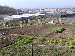
Hand in hand with social housing during this period came the growth of the allotment movement; and right alongside these tenements we discovered the Back Hamlet Allotments (77 plots, 1.63 hectares); one of 16 allotment sites that together provide 2,100 allotment plots and cover an area of 60 hectares (twice the size of the very spacious Christchurch Park). The typical rent today is a modest £41 a year for ‘ten rods’, an area large enough to feed a family with vegetables for a year.
Allotments originated from the enclosure legislation of 1845, where provisions were made for the landless poor to cultivate ‘field gardens’. To this day, the council remains very committed to allotments, but their benefits are now stated in very different and suitably modern terms: “Everyone benefits from allotments and their vital role in connecting people to the process of food production, enabling them to grow fresh cheap food, whilst reducing food miles. The Council believes that allotments not only promote good health through exercise, hard work and healthy eating, but bring the community together to share advice experience and a passion for growing.” Importantly, the council also recognises that “allotments are an important feature in our landscape. With the ever increasing demands on land for development they provide a low cost ‘green lung’, which benefits not only the allotment holders but also the community and the environment. Not only are allotments important for good and low cost food, they are also a valuable recreational facility combining healthy activity and social contact between residents of a wide age range, abilities and cultural backgrounds, fostering community cohesion. The benefits of allotments for health are achieved through exercise and a diet of fresh vegetables and fruit. Also from being part of a community that share knowledge, plants, tools, produce and more organised community activities.”
The council’s research also clearly identifies the benefits of allotments: 27% of plot holders spend more than 10 hours a week on their plot; 97% of plot holders think their allotment represents good value for money. The three main reasons people choose to have an allotment are 1) Healthy food 2) Exercise 3) Fresh air.
When asked “What is the one thing which would help improve your allotment field?” the highest response was ‘improved security’. Which was one reason we were starting to get nervous – at this moment it could be construed that we were ‘creeping along’ the edge of the allotment, intent on agri-theft.
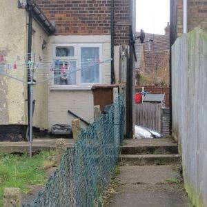
Now the life of an urban rambler is not always plain sailing. I still felt it was imperative we got a good look at these allotments, but it involved walking along a very narrow track between the bottom of residents’ gardens and the allotments, where all the least utilised paraphernalia of gardening, discarded kids’ play things and of course all the bins, were stored. At this point you want a sign to appear on your back saying “We are not casing the joint, promise, we are just urban ramblers’; but in the absence of there not yet being an app for placing signs on one’s back, we pushed on, trying in some fashion to look ‘officious and unstoppable’. Anyway, the track soon petered out, and we were forced to bear left, up the slope, towards the terraced houses; very fortunately there was an escape arch through the terrace that got us back on the public road. Phew. Safety.
Water plays an important part in the history of Holywells Park (27 hectares, 67 acres) Park, there being several springs that supplied the streams in the valley and later formed ponds and marshes. This is presumably where the name ‘Holy Wells’ comes from. There is reference to pilgrimages to the springs, legend attributing curative powers to them. Indeed these springs formed an important part of the Town’s water supply as early as the 12th century.
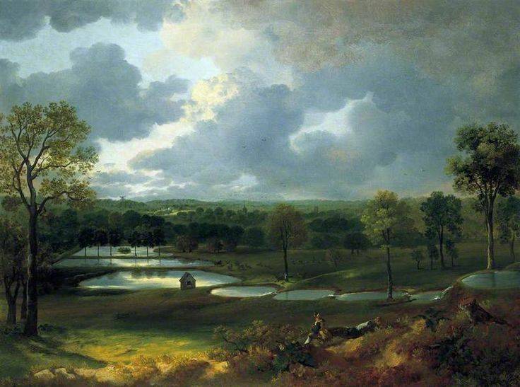
Thomas Gainsborough’s depiction of Hollywells Park, c. 1750; on display at Christchurch Mansion
It was also the pure water in plentiful supply that attracted Thomas Cobbold to move his brewery from Harwich to the nearby ‘Cliff’ in 1744. Previously he had transported the water in barges to Harwich. Thomas purchased the Park in 1789 and proceeded to construct reservoirs for his brewery by the creation of the ponds dammed in a stepped sequence.
The Cobbolds sold the Hollywells estate in 1930 to Lord Woodbridge who subsequently bequeathed it to the Town Council and it was opened as a park in 1936. Sadly the main house had to be demolished due to wood rot, but there are two listed outbuildings to visit, the stable yard and Orangery. The park is famously the subject of a picture by Thomas Gainsborough, who lived here in the 1750s.
The canal that we walked along as we head out of the park fed the water to the brewery. Cliff Brewery began life between the park and the quays in 1746. The current building of 1896 is a tower brewery by William Bradford and ceased operations in 2002. It has been unoccupied ever since, and in 2015 the Victorian Society named the building on that year’s Top Ten Most Endangered list. Hopefully the latest proposals will come to fruition: turning the building into a café, restaurant, business start-ups, an auditorium and a conference space, retaining as many of its original features as practical. It is certainly very well situated and an impressive, imposing building with an interesting local history.
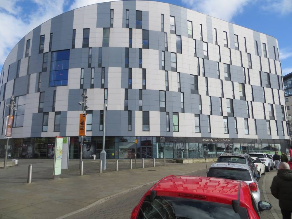
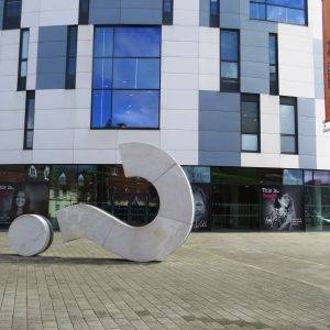
The University Campus Suffolk (UCS) Waterfront Building was opened in 2008. It is an attractive modern building, echoing two of the Willis building’s two most prominent features – glass walls and a grassed roof. This injection of youth and energy makes a big difference to the overall demeanour of the waterfront. A reminder of just how successful Ipswich has been over the last generation at preserving the fabulous history of the town with modern developments that have kept it thriving.
WALK DATA
Distance: 9.5 kms (5.9 miles)
Height Gain: 42 metres
Typical time: 2 hours 20 mins
Start & Finish: Duke Orwell Quay Car Park, off Duke St (IP3 0AQ)
Terrain: generally firm going, but can be muddy in a couple of places.
Access: The Ipswich train station gets you to a point close to the walk; Point 2 is a brisk 10-min walk from the station.
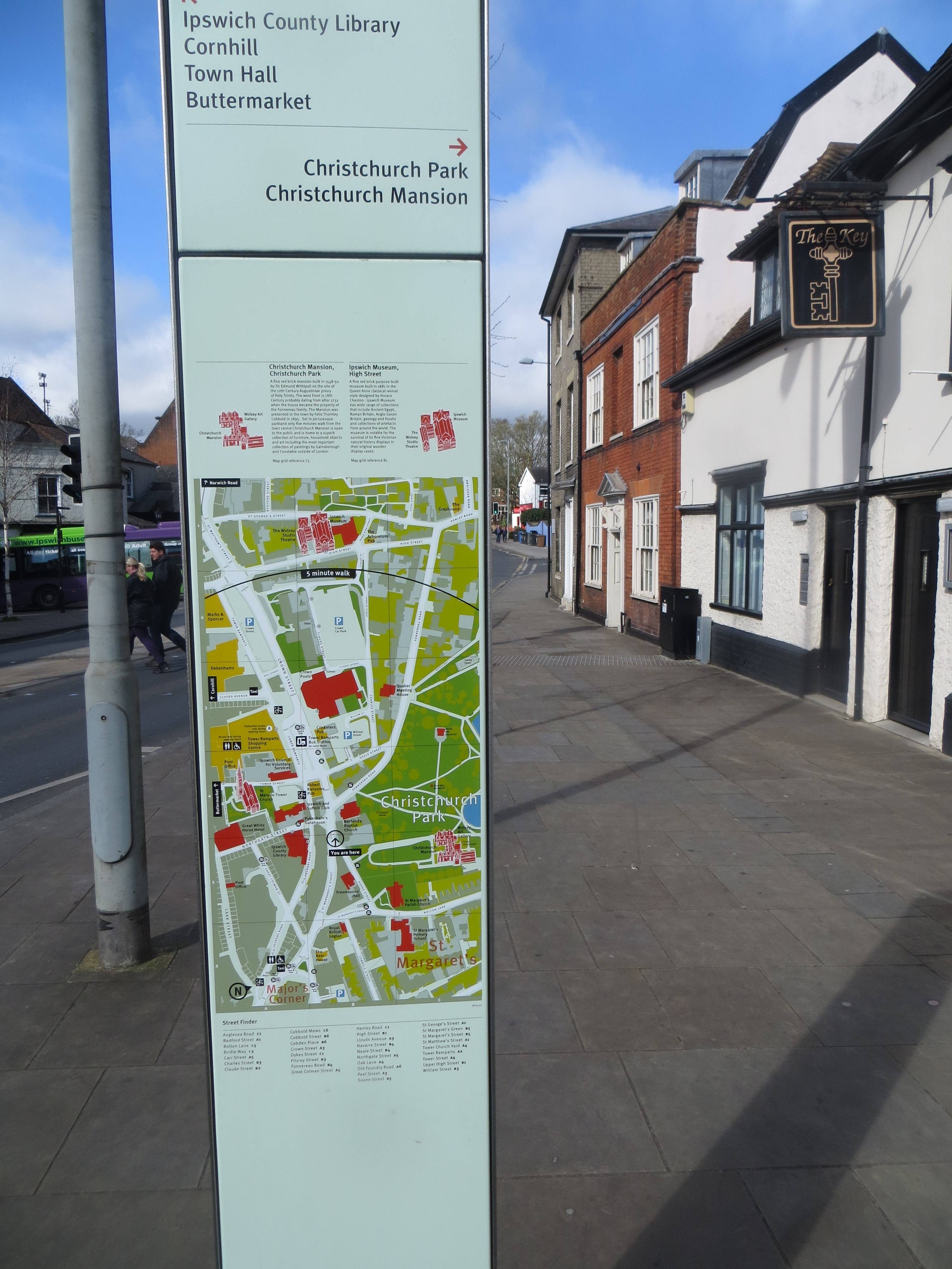
Ipswich gets top marks for its many street maps
DIRECTIONS
- Set out north along the quay from the Duke Orwell Quay Car Park off Duke St; follow it round as it bears west, past the Old Customs House until you reach Foundry Lane
- Cut north up Foundry Lane, past Dance East. Turn left at the busy College St and then right past St Peter’s Church, across Star Lane into St Peter’s St
- Head north up St Peter’s St, until you reach Cromwell Square; turn left (W) at the statue to the rugby legend Alexander Obolensky, then right along the east side of the Foster building, then kink left then right into Princes St
- Proceed up Princes St, then into the pedestrian area with the Town Hall on your left
- Turn right (E) into Tavern St and follow it along until you reach Tower St on your left
- Follow Tower St north, past St Mary-le-Tower church on your right, passing the town ramparts and crossing the busy Crown St; continue on the other side up Neale St, then left into Fonnerau Rd, and shortly on your right you will see the Fonnerau Rd entrance to Christchurch Park, which you enter
- Make your way NE through the park, walking on the west side of the Wilderness Pond until, just before it ends, you head west through the tunnel under the Bridle Way up to the Upper Arboretum; head up to the top of this, then cross back over the Bridle Way
- Now head east along Mayor’s Walk across the high point of the park to the Westerfield Rd exit, then turn left up the road, then shortly right into Gainsborough Rd
- At the end of Gainsborough Rd, turn left up Tuddenham Rd, then take a right up the Belvedere Rd; you will see a path up some steps on the left of the road, which you should take until you reach the cemeteries
- Turn right (S) into the Old Cemetery and wend your way down to the two chapels; after which you take some steps down to the southern exit to the cemetery; walk down Cemetery Road until you reach Suffolk Rd
- Turn right (NW) into Suffolk Rd, then bear right into Hervey St, at the end of which you cross over west into the narrow Parkside Avenue
- As the avenue bears sharp right, take the steps on the left down to Westerfield Rd; cross and head south until you reach the Bolton Lane entrance back into the park
- Swing down to the left (E) of the Round Pound, with the Tudor Christchurch Mansion on your left; exit by the Soane St exit
- Cross Soane St and the larger Crown St, turn right and then head left down Northgate; turn right back into Tavern St, then second left down Dial Lane
- Pass across Buttermarket, down St Stephen’s Lane and then bear left along a pedestrian route just before the Tourist Information Centre and then a passageway which leads onto Upper Brook St
- Turn right here (S) and follow the road down into Lower Brook St until you reach a pedestrian route, Rosemary Lane, on your left
- Take this (E) , past a rather ugly car park on your left, onto Foundation St
- Turn right (N) here and then shortly right (E) along the north side of the old monastery remains; this comes out into Lower Orwell St, continue on up into Fore St, then turn right into Eagle St
- Head east along Eagle St, which soon becomes the Rope Walk and take a diagonal right into the college campus, with a row of larch trees on your immediate left; at the far end, between the two college buildings you will see a gap and steps up to Alexandra Park
- Cross the park directly east, then take the path south past the water fountain and exiting by the Back Hamlet exit
- Turn left here up Back Hamlet and then take a right down a small track immediately to the east of the allotments entrance at the bottom of terraced gardens, alongside a wire fence; at the end of this you bear left up through an arch under the terraces into Devonshire Rd (if you feel apprehensive about this route just continue up Back Hamlet until you reach the top of Devonshire Rd, then turn right)
- Follow Devonshire Rd down to the bottom, then turn right into Cavendish Rd
- Shortly take a left into White Elm St, at the back end of this you will see the street (in very poor state, more like a path, continuing); as it is about to return to a normal road surface, bear left up some steps, onto Fore Hamlet Rd; follow this road up until you reach the entrance to Hollywells Park
- Enter the park, head south, cross the river and then keep the water to your immediate right all the way to the Cliff Lane exit
- Turn right here, cross the busy Hollywells Rd, turn right, then left into Toller Rd, right into Cliff Rd and then left into Ship Launch Rd
- As you approach the gates to the working quayside turn right and follow the Neptune Marina up on the east side until you reach the start point.
PIT STOPS
Applaud Café, 19 St Peter’s St, Ipswich, IP1 1XF (01473 808142, http://applaud-coffee.co.uk)
Tearoom at Christchurch Mansion, Soane St, Ipswich, IP4 2BE (01473 433554, http://www.cimuseums.org.uk/Christchurch-Mansion)
Stables Café at Hollywells Park, Stableblock, Holywells Park, Ipswich, IP3 0PG (07515 285692, https://www.facebook.com/Stables-CAFE-Holywells-Park-861036563955031)
The Cult Café on the Waterfront, James Hehir Building, University Ave, IP3 0FS (01473 338166, cultcafe.co.uk) Student-style café.
QUIRKY SHOPPING
The Walk: a good range of indie shops, including a delicatessen and gift shop.
PLACES TO VISIT
Ipswich Museum, High St, Ipswich, IP1 3QH (01473 433551, www.cimuseums.org.uk/Ipswich-Museum) Excellent on the history of Ipswich, but there are also exhibits of interest from around the world.
Christchurch Mansion, Soane St, Ipswich, IP4 2BE (01473 433554, http://www.cimuseums.org.uk/Christchurch-Mansion) Works by Gainsborough and Constable (apparently the biggest collections outside London), a Tudor kitchen and collection of Victorian toys and games.

30th January 2017 at 9:33 am
I live in Ipswich near the football ground and the size of the town is deceptive, behind the train station is the start of a massive joint est chantry/stoke park with 1000’s of houses leading down to the A14,
Ipswich has it’s problems that every large city or town has and drugs use and crime rates are high in parts of the town but i love liveing here and love the river walks, ipswich to stowmarket up the river Gipping or Ipswich to felixstowe up the river Orwell and the other side of the Orwell takes you up to shotley where the veiws across to Harwich Essex are stunning,
When up in shotley another walk is down the river stour down to the Essex Suffolk boarder the into another lovely town manningtree Essex where you can get a train 5 mins back to Ipswich,
I forget to say i love Ipswich town fc,
30th January 2017 at 1:29 pm
Your river walks sound interesting, thanks for the suggestions.