
Knowledge of Latin and the Greek would be useful for this walk
As urban walks through green spaces go, this is pretty hard to beat – it has a bit of just about everything; and if you still have energy at the end of it, there are myriad shopping opportunities, bookshops to browse through, museums to visit and places to eat & drink.
A detailed Ordnance Survey map of the walk can also be found at www.walkingworld.com Walk no. 7326
WALK DATA
- Distance: 9.8Kms (6.1 Miles)
- Height Gain: 30 metres
- Typical time: 2 ½ hours
- Map: Explorer 180 Oxford
- Start & Finish: Oxford Station (OX1 1HS); if coming by car, park in the Oxford Park & Ride
- Terrain: flat, easy going; suitable for energetic families
BEST FOR
‘Architectural Inspiration’
| Ancient Buildings & Structures (pre-1740) | Christ Church College, St George’s Tower at Oxford Castle |
| Georgian (1714-1836) | Radcliffe Camera |
| Victorian & Edwardian (1837-1918) | North Oxford (Norham Manor), Keble College Chapel |
| Modern (post-1918) | St Catherine’s College, The Florey Building, The Said Business School |
| ‘Green Spaces’ | |
| Parks, gardens, squares, cemeteries | University Parks, The University of Oxford Botanic Garden |
| Natural landscapes | Port Meadow, Christ Church Meadow |
| Rivers, canals, lakes | Oxford Canal, River Cherwell, River Isis (Thames) |
| Stunning cityscape | South Park, Ashmolean Roof Terrace Restaurant |
| ‘Fun stuff’ | |
| Great ‘Pit Stops’ | Jericho Café, Café Loco, The Head of the River pub |
| Quirky Shopping | North Parade, Oxford Covered Market |
| Places to visit | The Ashmolean Art Gallery, The Pitt Rivers Museum |
| Popular annual festivals & events | Oxford Literary Festival (late Mar), Oxford Foodies Festival (late Aug), St Giles Fair (early Sept) |
City population: 152,200 (2011 census)
Ranking: 52nd largest city in UK
Date of origin: AD 900
‘Type’ of city: University town
City walkability (www.walkscore.com): 97/100 ‘A walker’s paradise’
City status: Granted in 1542 (the cathedral is Christ Church chapel)
Some famous inhabitants: An extensive list can be found on Wikipedia at ‘List of University of Oxford People’
Notable city architects / planners: Too numerous to mention. There is a good architectural guide available online called ‘Discover Oxford’s Architecture’.
Films/TV series shot here: Inspector Morse series, Harry Potter films (Christ Church, Oxford Botanic Garden)
THE CONTEXT
Oxford is a city shaped by its rivers and academic history. The River Thames (Isis) to the west and the River Cherwell to the east define the old boundaries of the town, with the oldest buildings (mainly the colleges) to the south where the rivers join, and the housing moving through the centuries as the town expanded northwards to Summertown.
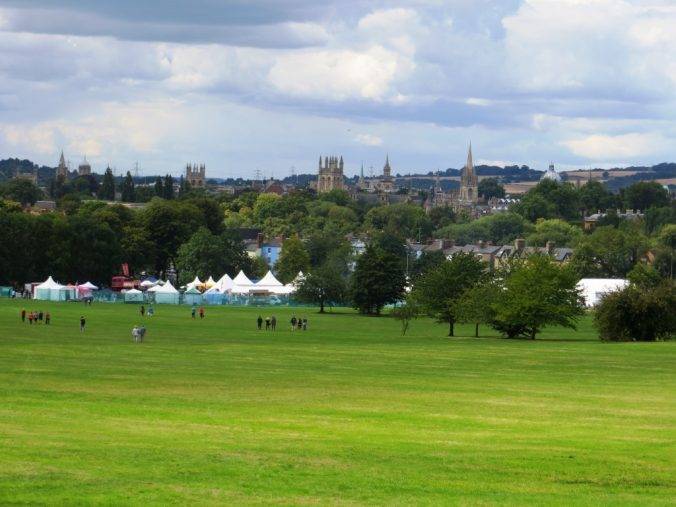
This walk takes you through the city’s finest green spaces. Starting at Port Meadow, the oldest continuously used meadow in the country dating back to pre-Domesday times, through the classic Victorian University Parks, where county cricket matches are still played; to the glorious vista of the city from South Park and the elegance and academia of Christ Church Meadows. With two rivers and a canal as your footpath for much of the route, this walk is a sheer delight. Oh, and you get to walk across two urban islands too!
THE WALK
Bring together a publisher & historian (Tony), a biology teacher (Sarah), a ‘dangerous places’ cameraman (Steve; whose father had been a professor of Russian at Oxford), a librarian (Patricia), an urban rambler (me) and friendships going back to university days and you have a group more than qualified to opine on just about everything en route – which is just what we did (although we could have done with a Latin scholar too).
Meeting at the station turned out to be the only unedifying experience of the day. A very uninspiring structure, created piecemeal between 1970 and 1990, and too small for the number of people trying to use it. At least there are now plans afoot to completely redevelop it.
Heading north out of the station, we soon came across the old track of the Varsity Line, dubbed ‘The Brain Line’, that linked Oxford with Cambridge until it was ripped up in a late 6os post-Beeching purge.
Young mathematicians, linguists and off-the-wall thinkers would have trundled out of here very ‘hush hush’ during the Second World War on their way to ‘Station X’, the code breaking centre at Bletchley Park. Roy Jenkins, who was an undergraduate at Balliol, went up to Bletchley in 1943 and worked in Testery, the hut devoted to cracking the Tunny codes. He subsequently became Chancellor of The University. Asa Briggs may well have trundled in this way at the end of the war to take up his new post as Fellow of Worcester College in 1945. He had worked in Hut 6, which was responsible for deciphering Enigma machine messages. Interestingly both men shared a passion for widespread social reform. Roy Jenkins was responsible for many of the wide-ranging social reforms of the late 1960s, most notably gay rights.
The good news is that services are due to resume on the Varsity Line between Oxford and Bedford in 2017 along re-layed track; sadly, part of the remaining route to Cambridge has been built over, and would require laying a new railway bed. It remains a dream for some, with commentators believing that this would complete the “London-Cambridge-Oxford tech triangle which is the kernel of cutting-edge high-tech industry developments in the UK.”


The Thames, as it runs through Oxford, is called the Isis (the reason is lost in the mists of time, but the Victorians maintained it was a distinct river until it met the River Thame at Dorchester-on-Thames and therefore merited its own Latin name). We followed the right bank up to the footbridge which took us on to Port Meadow.
It was under this bridge that the Reverend Charles Dodgson (better known as Lewis Carroll) rowed upstream one summer’s day in 1862 with Alice and her two sisters. He began at their request to make up a story that later was expanded into Alice’s Adventures in Wonderland.
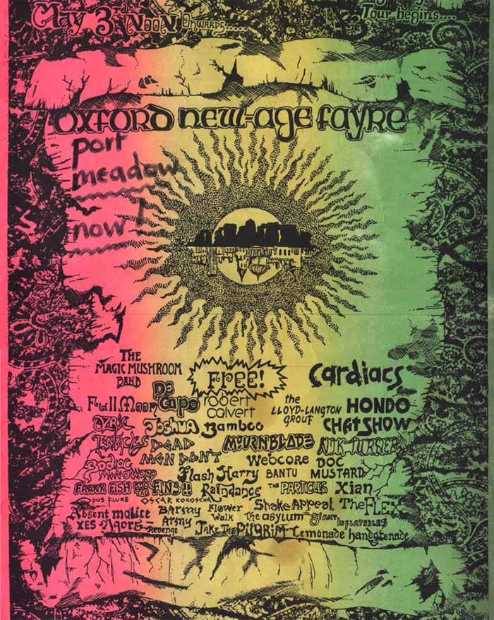
Port Meadow is the largest area of common land in Oxford, 178 hectres (440 acres) in all. Ever since it was gifted to the Freemen of Oxford in the 10th century by Alfred the Great, by way of thanking them for helping defend his kingdom against the marauding Danes, it has been used for just about every purpose imaginable in its long unfurrowed existence; from grazing horses and cattle, to horseracing in the 17th and 18th centuries (low stone bridges laid over washes and ditches for this purpose still survive) to warfare (there are the foundations of the fortifications from the Parliamentary siege of Oxford during the English Civil War here) to military encampments in both world wars; to ‘make love not war’ in the shape of free festivals and raves in the 1980s and 90s (which the police tried to control with a specially re-enforced tractor that enabled them to navigate the boggy bits). Today it is used for leisure of all sorts – walking, running, and, when the meadows are flooded and frozen over, skating.
And as if that weren’t enough, there are several Bronze Age round barrows and an area of Iron Age settlement; plus it is also a Site of Special Scientific Interest, with many species of birds and flowers. The fact that it has never been ploughed has made it a wildlife haven.
It is also a space that has inspired much poetry, most famously Gerard Manley Hopkins’ Binsey Poplars written in 1879, which opens:
My aspens dear, whose airy cages quelled,
Quelled or quenched in leaves the leaping sun,
All felled, felled, are all felled;
Of a fresh and following folded rank
Not spared, not one
That dandled a sandalled
Shadow that swam or sank
On meadow and river and wind-wandering weed-winding bank.
It is a space that people feel fearsomely protective of and there has been another incursion in recent years, this time in the shape of six high university accommodation buildings erected between the meadows and the city centre. A fierce campaign against them was fought and lost. In the words of our (generally very composed) walking companion Tony: “In case you think I’m unduly upset about Port Meadow, eulogised by some of our greatest poets, one of the classic views of Oxford skyline, the first sight you get of the spires as you approach downstream of the Thames, an untrammelled people’s land running right into the heart of the modern city, the views of the Dreaming Spires of Oxford vandalised for ever, I am.” Not perhaps quite the same poetic grace as Hopkins, but certainly the same type of sentiments and passion for this memorable open space.
Tony’s mood took a while to shift, but we moved on and soon found ourselves in North Parade, famously and somewhat incongruously situated to the south of South Parade. Tony, who by now was getting his customary equanimity back, donned the more comfortable role of local historian and explained: “During the Civil War when Charles I was besieged by Oliver Cromwell at Oxford, South Parade was the Roundhead southern front, whilst North Parade was the location of the Royalist northern front during the siege of Oxford.” Apocryphal or not, I like that story. Today the street is very far from a front line, replete with indie shops, trendy restaurants and an open food market.


From North Parade we crossed into the heart of ‘North Oxford’, one of the country’s finest Victorian residential areas, full of huge mansions with every imaginable High Victorian architectural twiddle: statement porches at the top of flights of steps, large bays, brick patterns, complicated rooflines, crenellations, plaques & crests and many spires and larger than strictly necessary chimneystacks. In the nineteenth century, it was developed for the well to do merchants of Oxford by St John’s College, but today it is typically inhabited by successful academics and Londoners seeking more space and cultured living. Plus there is a lot of student accommodation here, with the tell-tale stack of bikes leaning against the wall by the front door, and many bells to push.
Steve wanted to take us past his old Prep school, The Dragon School, which we reached via Park Town, the first planned, middle-class estate in the area, comprising 70 houses in total. Samuel Seckham, the architect, had a constricted space to work with, but ingeniously managed to create an estate that combined terraces and villas. The scheme depended on sacrificing large back gardens for communal gardens and planting in the central area. The first houses, on the west side, comprise villas with gardens; then moving eastwards there are terraces with a communal garden, then villas again and finally the smallest houses at the back. The variety of house types and the change in road width gives the illusion of a much larger estate, and the position of the houses and the planting contributes to a sense of seclusion and exclusiveness.


Through an archway at the back of the estate are Dragon Lane and the Dragon School, which numbers amongst its illustrious alumni Sir John Betjeman. As we walked through the walled passageway to the University Parks alongside Lady Margaret Hall, Steve was reminded, by the echo of our walking boots, of the din of a hundred excited feet as the Dragon boys rushed to the park for exercise.
The University Parks are in what feels pretty much like the heart of Oxford today, but used to be part of the fields to the north of the city centre. They were officially created in 1853, but the space was used for leisure long before that. King Charles II is reputed to have walked his dog here in 1685 (probably without a pooper-scooper I’m guessing).
One of the objectives in laying out the Parks was the provision of facilities for team sport for members of the University, and this is still very much in evidence as we strolled through today. It is home to the Oxford University Cricket Club and a venue for first-class cricket matches; the only ones in the country apparently that you can enjoy free of charge. It is also the venue for many other team sports.
The sporting tradition has seen a more recent novelty with the park becoming the home of the Oxford Quidditch league. Now Quidditch, as I’m sure you will recall, is the fictional game played in the Harry Potter books requiring impossible feats of aerobatics. Somehow, the enterprising students of Oxford have managed to create a ‘ground’ version of the game and codified it in the official Rulebook, the IQA, which was formally adopted in 2012; since which time there have been many inter-college, inter-university and even international games.
Provision of a bathing place alongside the river featured in the earliest discussions on the recreational use of the Parks. Parson’s Pleasure, close to the rollerway which transports punts around the weir, was reserved for the use of male members of the University, and became a popular place for nude bathing. Similarly, Dame’s Delight on the river bank opposite Mesopotamia Walk was reserved for ladies’ bathing.
Parson’s Pleasure was traditionally frequented by dons of the University. Ladies sitting in passing punts were saved from potential embarrassment by being directed to a path that skirted the area behind a high corrugated iron fence. If a pretext was needed, the ladies could be told that the men needed to haul the punt over “the rollers” – a track made of concrete with metal rollers – next to the nearby weir.
One anecdote has it that a number of dons were sunbathing nude at Parson’s Pleasure when a female student floated by in a punt. All but one of the startled dons covered their genitals – Maurice Bowra placed a flannel over his head instead. When asked why he had done that, he replied haughtily, “I don’t know about you, gentlemen, but in Oxford, I, at least, am known by my face.”
(The River Cherwell footbridge which you have just crossed, incidentally, is Grade II listed courtesy of the fact that it was the first pre-stressed concrete bridge in Britain, built in 1949. They don’t do anything it seems in half-measures in Oxford.)
Mesopotamia is a narrow island, about half a mile long but not much wider than a tennis court, that lies between the upper and lower levels of the River Cherwell, just south of Parson’s Pleasure. The name Mesopotamia in Greek means ‘between the rivers’ and originally referred to the area between the Tigris and Euphrates rivers in present-day Iraq.
We had the sensation at this point of being totally in the countryside – celandines and willows all around us, looking across the river and over a field of cut reeds in the sunshine, beyond which small figures of walkers and cyclists went peaceably to and fro. A living vision of the pastoral idyll.
In the distance to yur right is St Catherine’s College, the quinessence of cool modernism, built in the early 1960s. Every detail, from the cutlery and furniture to the landscaping, was worked through by the Danish architect, Arne Jacobsen.


The 19th century academic wag who had labelled this little island ‘Mesopotamia’ could not have guessed that a hundred and fifty or so years later the Middle Eastern theme would be continued and the Oxford Centre for Islamic Studies (OCIS), including a mosque and minaret would be built just below the island where the path exits via King’s Mill. One of its founders commented in the Oxford Times: “Hopefully it will bring out that there is more in common with Islamic and Western architecture than most people realise, such as domes and quads.”
And thence into South Park and one of the most iconic views (I promise only to use that word once in this blog – this is it!) of any city in Britain – the Jude the Obscure view, gazing over the spires of Oxford and beyond and dreaming of what might just be possible… we whooped down the hill in delight, and the day we were there, there was a fair at the bottom where it meets St Giles – happy families and children, a scene of jollity and celebration. There is often an event here, be it the Foodies Festival, The Lord Mayor’s Parade, the annual Fireworks Display or OxfordOxford, a weekend-long music, film and community festival.
South Park only became a protected and public space comparatively recently. The land was privately owned by the Morrell family of Headington Hill Hall until 1932, and was used for farming. The Oxford Preservation Trust bought the land in 1932; and in 1959 gave it to the City of Oxford to be preserved as an open space for the benefit of the public. A carved stone by the sculptor Eric Gill is located at the foot of the Park and records the Trust’s gift thus: ‘This park was acquired by the Oxford Preservation Trust through the liberality of the Pilgrim Trust and David and Joanna Randall-McIver in 1932’.
The Friends of South Park are typical of many groups up and down the country that have got together to represent the local community for the benefit of the park and its users. Their goals are illustrative of how constant the issues and benefits of green spaces have been over the generations:
- Influencing South Park’s appearance (railings, tree maintenance, litter, dog fouling)
- Having a say in its facilities (play area, toilets, benches, bins, etc.)
- Being a consultee for the events that happen within the park
- Improving its biodiversity
- Promoting exercise, health and wellbeing activities in the park
- Organising community events
When you think Oxford you tend to think ancient buildings, but look out for the Florey Building, built at the end of the 1960s, on the right as you walk along St Clement’s. Designed by James Stirling and Partners as student accommodation for Queen’s College, its unusual sculptural shape and bold use of bright red brick divided taste. It was listed Grade II in 2009. The curved glass front of the building forms a private courtyard.


Next, we traipsed over Magdalen Bridge. The annual May Day celebration starts here at first light with the Magdalen College Choir singing the ‘Hymnus Eucharisticus’, from the top of the Magdalen Tower, a tradition that has been going on for over 500 years. Large crowds gather under the tower along the High Street and on the bridge, many the worse for wear after all-night balls, incongruously attired for such an early hour in formal wear and tiaras.
The tradition of jumping off the bridge into the River Cherwell, which I also imagined to be steeped in tradition, apparently only began in the early 1980s and was banned in 2005 after around half the hundred or so jumpers required medical treatment due to the shallowness of the water. Since then, the scene of idyllic celebration of the arrival of spring has been rather marred by a phalanx of security men on each parapet of the bridge, donned in ‘high vis’ jackets and determined to stop anyone from jumping.
Nearly as old as The May Day Celebrations, The University of Oxford Botanic Garden celebrates its 400th anniversary in 2021. It is the oldest Botanic Garden in Great Britain and one of the oldest scientific gardens in the world. It was founded as a physic garden growing plants for medicinal research. Today it contains over 8,000 different plant species and is one of the most diverse yet compact collections of plants in the world, including representatives from over 90% of the higher plant families. As well as being the oldest, it was also the inspiration behind the creation of Botanic Gardens in many British cities in the nineteenth century, when collecting plant species became so popular with well to-do Victorian gentleman.
Lewis Carroll was a frequent visitor to the garden and it was another source of inspiration for Alice’s Adventures in Wonderland. The Garden’s water lily house can be seen in the background of Sir John Tenniel’s illustration of ‘The Queen’s Croquet-Ground’.
Another Oxford professor and author, J. R. R. Tolkien, often spent his time in the garden reposing under his favourite tree, Pinus nigra. It has been observed that this enormous Austrian pine is much like the Ents of his The Lord of the Rings story, the walking, talking tree-people of Middle-Earth.
Finally, the tour de force of our walk, Christ Church Meadows. Roughly triangular in shape, it is bounded by the River Thames, the River Cherwell and Christ Church College. On the summer’s day that we were there, it was flocked with people walking, picnicking, enjoying the river and (a few) even revising.


Being a big open space of course, people have also wanted to use it for getting places. James Sadler, the Richard Branson of his day, made the first ascent in a balloon by an Englishman from the Meadows in 1784. The balloon apparently rose to a height of around 3,600 feet and landed six miles away.
More alarmingly, the Meadows were also earmarked for a relief road in the early 1960s. What became known as the Jellicoe Plan was unveiled in 1963 and consisted of a landscaped, sunken road through the middle of the meadow.
His report was surprisingly matter-of-fact about the whole scheme: “In order to preserve the space of the meadow intact, the objective is to make a neat cut, insert the road, and join the parts together by illusion, so that they again become one.”
Thankfully the plan eventually got kicked into ‘the long grass’. Something good, though, did come out of the near-disaster. The country’s first park-and-ride scheme was set up in Oxford in 1973 to help relieve the traffic congestion.
Nowadays, proposing to concrete over one of Oxford’s sensitive green spaces would be seen as heretical. In 2012, the Dean of Christ Church, the Very Rev Christopher Lewis, reflected: “Human progress is an interesting phenomenon. Now it would be unthinkable to have a road across the meadow which is, as people know, a wonderful feature of central Oxford. One of the ways we have advanced is that we are more conscious of green space and more conscious of the history of particular areas.”


One final thing before we leave the meadows. Steve, our intrepid cameraman, took us to a locked underground culvert on the north west side of the meadow, which gives access (now illegal) to an underground river called the Trill Mill Stream, that runs from Christ Church Meadows to Paradise St. Steve, it turned out, had canoed along it with a friend during the long, hot summer of 1976. It turns out other notable canoeing alumni include undergraduates T. E. Lawrence and Hubert Matthews. It enjoyed a most insalubrious reputation: aristocratic Christ Church and the slum dwellers of St. Ebbe’s were equally condemned for polluting it, earning it the ironic nickname Pactolus – the stream in which Midas bathed.


From here we took the delightful river route (south & west side) back to the station, pausing to admire the Said Business School just to the east of the station, built in 2002 and reflecting Oxford’s desire to try and keep up with the (more commercial) times. Its sleek lines and distinctive green Ziggurat tower make it a welcome addition to the built environment and put the station to shame.
THE ROUTE
- Take a left out of the station and follow the sign to the Canal (also a cycle track), through Stable Close, turning left when you reach the water, over a bridge then bearing round to the left to reach the east side of the Thames (Isis). Head north, over Fiddler’s Island, until you reach the footbridge into Port Meadow
- Cross this bridge and head E to Walton Well Rd. Proceed along it to Kingston Rd, then take a left and a right into Plantation Rd. Follow it E and cross the main Woodstock Rd, then head north a hundred yards or so
- At this point turn right along Church Walk, passing the Oxford Centre for Mission Studies, and then along North Parade Avenue into Banbury Rd. Cross over, turn left and head north for 100 yards or so
- Turn right into Park Town and walk all the way through to Dragon Lane at the back
- Turn right and follow Dragon Lane until it meets Norham Rd. Turn right then left into Fyfield Rd, at the end of which, alongside Lady Margaret Hall, there is a passageway into The University Parks
- Once in the park, skirt round to the left towards the pond and go round it to meet the River Cherwell. Head S along the riverbank, then exit at the SE corner, and head E
- Shortly cross a bridge E over Hollywell Mill Stream into the area known as Parson’s Pleasure. Turn south just before another bridge, then turn left across another gated wooden bridge onto the thin island called Mesopotamia; then follow Mesopotamia Walk south, with the river on either side. The path goes past a mill and then into King’s Mill Lane, to reach the main Marston Rd
- Cross the road by the Mosque and proceed E up Cuckoo Lane and then enter Headington Hill Park. Turn left immediately and head up to the top of it, then turn right and stay on the higher contour, with Headington Hill Hall just above you, until you find an exit into Headington Rd. Cross over into Cheney Lane; then follow this until you reach an entrance south into South Park
- Turn down into the park, and you will be met by fabulous views of the spires of Oxford. Rejoin the Headington Rd and follow it along St Clement’s to the roundabout (The Plain); bear right into the High St and over Magdalen Bridge
- Turn left just at the Botanical Gardens into Rose Lane, thence onto Merton Playing Fields and Christ Church Meadows. Follow the River Cherwell downstream to where it meets the Thames, and then follow the larger river upstream to Folly Bridge. Go through a metal gate past the Head of the River Pub onto Aldates
- Cross the Folly Bridge, and immediately afterwards turn right along the Thames Path. Follow this all the way until it meets the Botley Rd, then turn right and you will shortly see the station.
PIT STOPS
The Jericho Café, 112 Walton St, OX2 6AJ (Tel: 01865 310840 www.thejerichocafe.co.uk); just S of the route after Port Meadow. Informal, good range of food, huge cakes and delicious coffee.
Café Loco, St Aldates, OX1 1RA (Tel: 01865 200959 www.goingloco.com); a couple of minutes north from the Head of the River brings you to this beautiful café serving delicious food throughout the day, with views of Christ Church and its meadow.
The Head of the River Pub, St Aldates, OX1 4LB (Tel: 01865 721600; www.headoftheriveroxford.co.uk). A converted 19th-century warehouse wedged between the Thames and Christ Church Meadow, with great river views.
QUIRKY SHOPPING
North Parade has a food market every alternate Saturday, and interesting indie shops, including the Oxford Yarn Store.
The Covered Market, High St. Lots of individuality and interesting items. The market has been trading for over 200 years. Find out more at www.oxford–coveredmarket.co.uk
Broad Street has a changing roster of small shops but has always been home to Blackwell’s (48-51 Broad Street, Oxford, OX1 3BQ; Tel: 01865 792792, www.blackwell.co.uk). Oxford’s original bookshop has since spawned Blackwell’s Music (23-25) and Blackwell’s Art and Poster Shop (27) across the road.
At the top of St Giles, foodies will love Taylors Deli, 31 St Giles, OX1 3LD (Tel: 01865 558853, www.taylorsoxford.co.uk) very much an Oxford institution.
PLACES TO VISIT
The Ashmolean Museum of Art & Anthropology, Beaumont Street, OX1 2PH (Tel: 01865 278002; www.ashmolean.org) Established in 1683, it is Britain’s oldest public museum and one of the oldest museums in the world. Especially notable for its pre-Raphaelite art collection.
The Pitt Rivers Museum, South Parks Road, OX1 3PP (Tel: 01865 270927; www.prm.ox.ac.uk) The wonderful Victorian Gothic building is the Oxford University Museum of Natural History and you go through this museum to get to the Pitt Rivers Museum. Both museums have superb collections.
26th February 2016 at 5:20 pm
I enjoyed this description of my city and a walking route that takes in many places and sights.
I think there might be a tiny confusion with you references to the Pit Rivers Museum. A confusion also shared by whoever is responsible for the road signs in Oxford.
The wonderful Victorian Gothic building is the Oxford University Museum of Natural History and you go through this museum to get to the Pit Rivers Museum. Both museums have superb collections.
29th February 2016 at 4:22 pm
john, thanks for your comments; and i have adjusted the description of the museums as you suggest.
Kind regards
Nicholas
28th November 2018 at 11:10 am
As you left the station, did you pass the remains of the railway swingbridge over the canal linking the Isis and the Oxford Canal? For those interested in industrial archaeology, it is interesting.
1st May 2019 at 4:13 pm
We did. fabulous thing to see, thanks for the comment.