
Reams of history, fabulous buildings, diabolical road system
This walk takes you past many of the historic sites of Worcester connected with the English Civil War and has a lovely stretch along the canal and the River Severn.
‘Green Spaces’
| Parks, gardens, squares, cemeteries | Pitchcroft, College Green, Fort Royal Park, Diglis Playing Fields, Cherry Orchard Nature Reserve |
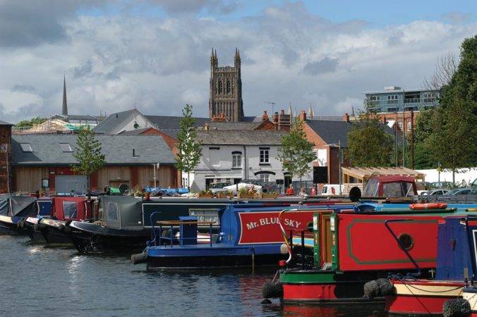
| Rivers, canals, lakes | Worcester & Birmingham Canal, Diglis Basin Marina, River Severn |
| Stunning cityscape | Fort Royal Park |
‘Architectural Inspiration’
| Ancient Buildings & Structures (pre-1740) | King Charles House (16th C), Worcester Cathedral (12th C), Edgar Gate (13th C), The Commandery (13th C), Berkeley Court Almshouses (1705) |
| Georgian (1714-1836) | 61 Broad St (1740s), St Swithun’s Church (1730), The Guildhall (18th C) |
| Victorian & Edwardian (1837-1918) | Victoria Institute (1884), Shire Hall (1834), Kays & Co. (1907) |
| Industrial Heritage | Royal Worcester Porcelain Factory |
| Modern (post-1918) | The Hive (2012), Odeon Cinema (1939), Gaumont Cinema (1935), King’s School Boathouse (2013) |
‘Fun stuff’
| Great ‘Pit Stops’ | Chocolate Deli, Floating Café |
| Quirky Shopping | Hopmarket Hotel, New St |
| Places to visit | Greyfriars, Worcester Cathedral, Worcester Porcelain Museum, The Commandery, Diglis Miniature Railway, Worcester Cathedral |
| Popular annual festivals & events | Three Choirs Festival (July, tri-annual), Worcester Festival (Aug) |
City population: 100,842 (2011 census)
Ranking: 50th largest city in UK
Date of origin: 400BC, trading route
‘Type’ of city: cathedral city
City walkability (www.walkscore.com): 98/100 Walkers’ Paradise
City status: since time immemorial
Some famous inhabitants: Edward Elgar (composer), Sir Tomas Brock (sculptor), Sir Charles Hastings (founder of British Medical Association), Philip Gosse (naturalist), Chris Tarrant (TV show host), Kit Harrington (Game of Thrones actor)
CONTEXT
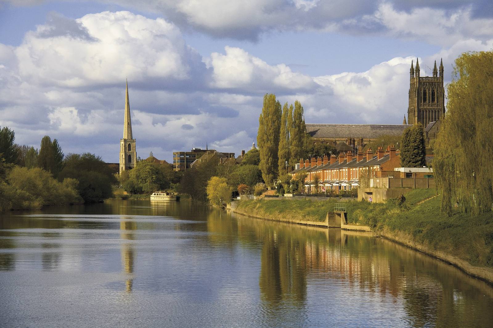
It’s hard to imagine that Worcester is only 17 miles southwest of Birmingham, connected by the Birmingham & Worcester Canal, but a world apart in terms of history and outlook – very much a traditional ‘shire’ city – but having, of course, what Birmingham lacks, a large river running through it.
Indeed the River Severn has dominated the town in so many ways. Even the name is linked; the ancient name for the city was Weorgoran Ceaster, ‘Weorgoran’ meaning the ‘people of the winding river’ in Old English. Its strategic position alongside a ford crossing the river meant that it was inhabited from a very early, pre-Roman era and was always a fortified and important trading post as well as a seat of religion.
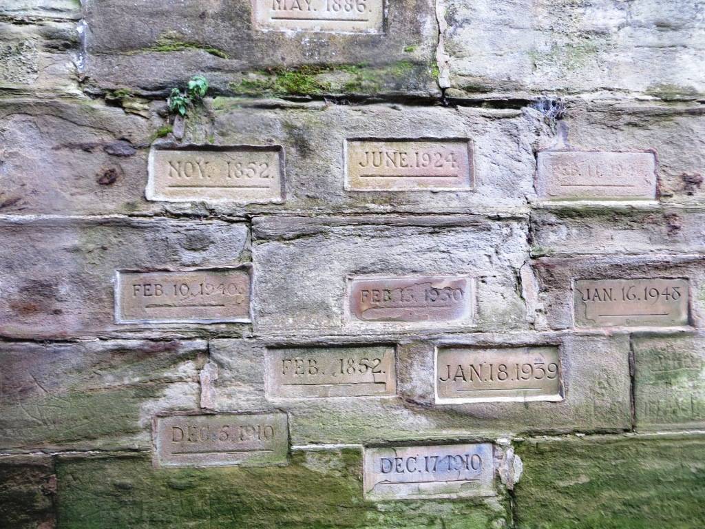
But flooding has always been a problem. In 1670, the river broke its banks and the subsequent flood was the worst ever seen by Worcester. A brass plate can be found on a wall on the path to the cathedral showing just how high this flood went; and other flood heights of more recent times are also shown in stone bricks, including the floods of 2007.
The first and last battles of the English Civil Wars – the 1642 Battle of Powick Bridge and the 1651 Battle of Worcester – were fought here, reflecting once again its strategic location. The Battle of Worcester was one of the largest land battles ever fought in England, with the Parliamentarians outnumbering the Royalists by 28,000 to 12,000. The action raged over the fields and hills to the south of Worcester and culminated with street fighting in the city itself. By the end of the day over 3,000 Royalists were dead and much of the remaining Royalist army taken prisoner. King Charles fled to France and so began the eleven-year Interregnum.
During the late 18th and early 19th centuries, Worcester was a major centre for glove making, employing nearly half the glovers in England, over 30,000 people at its peak. In 1815 the Worcester and Birmingham Canal opened, allowing Worcester goods to be transported to a larger conurbation.
During The Second World War, the city was chosen to be the seat of an evacuated government in case of mass German invasion. The War Cabinet, along with Winston Churchill and some 16,000 state workers, would have moved to Hindlip Hall, 3 miles north of Worcester; and Parliament would have temporarily sat in Stratford-upon-Avon.
In the 1950s and 1960s large areas of the medieval centre of Worcester were demolished and rebuilt as a result of decisions by town planners. This was condemned by many, such as Nikolaus Pevsner, who described it as a “totally incomprehensible… act of self-mutilation”; and by the journalist Geoffrey Moorhouse who wrote an article headlined ‘The Sack of Worcester’, in which he was severely critical of the scheme, saying the resulting demolition around the Lychgate area was destroying precious heritage and made the city look as if it had been the victim of a bombing raid. The redevelopment has gone down in town planning history as an example of how not to do things, albeit there had been an urgent need to sort out badly dilapidated slum dwellings.
Sadly then, alongside the great buildings and rich history, the city still has to live with several blots on the landscapes from this era, notably the diabolical ring road system and ugly, poorly built shopping centres. My ‘favourite’ blot on the landscape is a set of escalators going straight up off the medieval High St making the place look like an airport.


As the council itself acknowledges; “Arrival at the heart of the city can be disorientating and disappointing by any mode. Car parks are abundant and the rail and bus stations are centrally located but motorists are bound up by highway restrictions which often force drivers into counter-intuitive directions of travel.”
To be fair to them, it’s the age old problem of trying to create a modern road system overlaid on a medieval road pattern, with in their case one hand tied behind their back in the shape of the River Severn, which is a huge natural barrier with limited road crossings, leading to a high concentration of through traffic in the city centre.
And at least the council now has a laudable ‘Vision for the City Centre’ (2010) which, amongst other things, stresses the importance of walkability and the continuing leisure potential of the river: “It will be unrivalled within the West Midlands as a city that combines all of the excitement and bustle visitors would expect to find, with a celebration of the beauty, richness and interest to be found in one of England’s most important historic cities, and with a level of convenience and compactness which makes it very easy to get to and very easy to walk around.
“It will offer enhanced choices for accessing the city centre as provision for walking, cycling and using public transport improves, and as the city’s streets and spaces are made more attractive. The city centre will make more of its natural environment. In particular the riverside will become a focus for leisure and entertainment; for boating and cycling, watching a performance on a summer’s evening, visiting artists markets on a Sunday morning, and just sitting and watching the world go by.”
Much has already been achieved and there are some very worthwhile plans in the pipeline:
- Revitalisation of Cornmarket, making it a more agreeable and usable open space, “improving, enhancing and reclaiming it as a focal space for the city”
- Cathedral Square: creating a continental-style open piazza, a vital green space in a congested part of the city – under construction, due for completion in 2017 (this is where the wrecking ball of the 1960s had been at its most ferocious)
- The Green Sky Walk, a kilometre long walkway à la High Line making use of parts of the disused viaduct, linking the east and west of the city by foot and pedal.
Worcester is yet to become a truly walkable city, with much to admireand enjoy but a road system and shopping developments that remain blots on an otherwise truly historic tapestry.
THE WALK
We de-trained (love to get that word in) at Foregate St Station, which is different in several ways from your typical station. First of all, it’s built on a viaduct, limiting its space for expansion; secondly, the layout is unusual in that the two platforms serve different routes, rather than different directions; third, and perhaps most intriguing, is that the men’s toilet has been converted into an arts space, called Movement (two puns there?) – ‘an artist-led gallery showing exhibitions by international artists ‘to take rail passengers on a conceptual journey’ as their Facebook page explains.
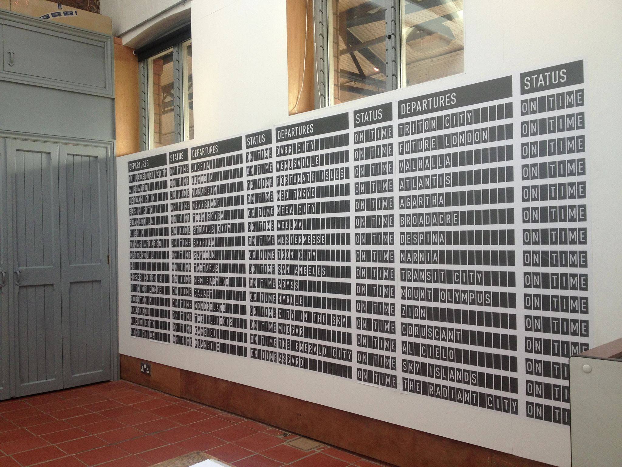
Departures by Alicia Framis
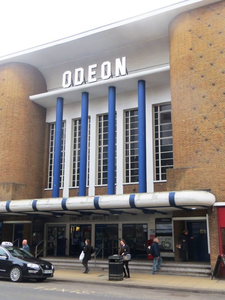
Heading north, we immediately saw the Odeon Cinema on our left, a beacon of art deco in the city, built in 1939 and a reminder of the time when there were five cinemas, and movies were the internet of their day. There can be few architectural styles which so immediately conjure up a familiar activity, and this is certainly one of them – in my case I immediately think of going to early James Bond movies with my dad, and an ice cream tub.
Further up on the right we soon spot The Gaumont Cinema, another 30s gem but in a somewhat different style, and now a bingo hall – it has an impressive pedigree of gigs, having hosted Buddy Holly, The Beatles, The Rolling Stones, Jimi Hendrix, Mott The Hoople, Queen and David Bowie. Everyone has to start somewhere and this is very much that sort of place.
One of the great legacies of the era of Victorian prosperity was the opening of public libraries, and Worcester was just one place where a magnificent new public building was constructed. In 1884, a campaign started in the city to build a combined museum, library and school of art and science in time for the jubilee of Queen Victoria, to be called the Victoria Institute. This striking building, with its distinctive facade and single turret, was opened in 1896. The entrance comes complete with a huge royal crest, and a pair of wrought-iron gates to keep out the over-eager reader when the library is shut. Inside the Institute there is an impressive entrance hall, complete with a magnificent staircase to the first floor museum and art gallery. Don’t forget to look down at the mosaic floors before you leave the building.


Set back from Foregate Street, the Shire Hall was built in 1834-5, and, like so many civic buildings of this earlier Victorian period, has the look of a Greek temple about it. The design, by Charles Day and Henry Rave, has a frontage of six pillars, behind which is a huge door, making a fittingly imposing entrance to Worcester’s Crown and County Courts, which are held in the building. (Crown Court buildings could be the subject of their very own book on architecture…)
In the centre of the car park is an imposing statue of Queen Victoria, the work of the Worcester-born sculptor Sir Thomas Brock. He is the man responsible for two of London’s best known landmarks: he was commissioned to finish the Albert Memorial, and he also designed the huge Imperial Memorial to Queen Victoria in front of Buckingham Palace.
Kays and Co, the Tything: These offices for the mail order company that became synonymous with Worcester were built in 1907 by JW Simpson and Maxwell Ayrton. The most notable features are the simple but elegant windows, visually bound together by bands of pale stone amid the brickwork. For me, though, what catches the eye is the fabulous Arts and Crafts lettering over the main entrance. It speaks of a firm that celebrated style!
Racing has taken place at the Pitchcroft course, close to the banks of the River Severn, since at least 1718, making Worcester one of the oldest racecourses in Britain. The first meetings were flat races. By 1755 a four day flat meeting had been introduced with a jumps fixture in the autumn.
The course has undergone many changes, including the layout in 1880 of a new track that featured a now long-defunct figure-of-eight course. Flat racing was discontinued in 1966, but the National Hunt meetings continued to provide competitive racing with large fields. Summer jumping started at the course in 1995.
During the first English Civil War, Royalist soldiers used Pitchcroft as venue to recruit new members, drill and practise their archery, hence the naming of the nearby Butts, where the arrows fell at the foot or butt of the city walls.
Today Pitchcroft is an open space for the people of Worcester to enjoy 365 days a year, but byelaws allow the footpaths to be closed whenever race meetings take place on the 22-acre track.


It’s not hard to spot The Hive, which has a very distinctive external appearance, created by its gold-coloured cladding and prominent roof profile, formed by seven upward-facing ‘cones’. The Hive can be viewed from many vantage points across the city and sits in strong contrast to the majority of the city’s medieval, Georgian and Victorian architecture.
Opened in 2012, The Hive houses archive collections including William Shakespeare’s marriage bond to Anne Hathaway, a quarter of a million books and more than 45,000 records of historic monuments and buildings, as well as the Worcestershire Hub city branch, a business centre, café and meeting facilities. The award-winning design of the building uses advanced environmental technology to improve sustainability, including river water cooling and a bio-mass boiler when heating is needed.
We could see no way round this, but at this point the route took us past the really rather horrible Crowngate Shopping Centre, down Angel Place. If you are trying to squeeze some history or interest out of this spot, then perhaps I should tell you that Mr Lea and Mr Perrins originally met in a chemist’s shop on the site of the now Debenhams store in the 1890s and conceived the product that was to become the famous Lea & Perrins sauce.


But there is a reason for coming this way; we wanted to take a look at the rather splendid 61 Broad Street, now Skipton estate agents. You have to look up above the hubbub and shop fronts to admire what Nicholaus Pavsner described as “one of the collector’s pieces of Worcester”. It is a four-storey mid-Georgian (1740s) brick house that is only one bay wide. There is a Venetian window on every floor and a delightful domed belvedere at the top.
St Swithun’s Church is a Grade I listed building now under the care of the Churches Conservation Trust. The church is considered to be “one of the best preserved examples of an early Georgian church in England”. Clifton-Taylor includes the church in his list of ‘best’ English parish churches. The earliest documentary evidence of the church is in 1126 when Eudo, Dean of Worcester, gave permission for the nearby Benedictine priory to build a church on his land. The resulting church was dedicated to Saint Swithun. The tower of the present church dates from the 15th century, but between 1734 and 1736 the rest of the church was rebuilt and the tower was refaced. The architects were Thomas and Edward Woodward of Chipping Campden.
Now, I admire very much what the Churches Conservation Trust does, but to me this is another example of Worcester not quite having its act together. The church doesn’t look well loved, at least from the outside; and often has a market stall parked outside its eastern end, which looks very incongruous, hot dogs and Holy Communion separated only by stained glass.
New Street is Worcester’s most agreeable street by a long stretch; ancient buildings, indie shops and one or two pieces of interesting modern architecture too.


Its most famous building is King Charles House, from whence King Charles fled to Spain after losing the battle of Worcester in 1651. Today it’s a pub, with a reputation for real ale and good pies.


The statue of Edward Elgar stands just north of the cathedral at the end of the pedestrianised High Street. Elgar was born in nearby Lower Broadheath in 1857. He spent much of his childhood at the music shop run by his father, just a few yards from the statue. He was an accomplished organist and violinist, as well as being a teacher.


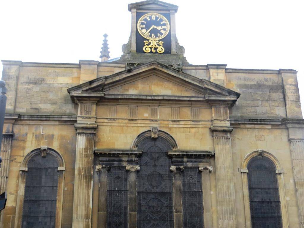
Worcester Cathedral is one of England’s most beautiful cathedrals, with royal tombs of King John and Prince Arthur, medieval cloisters, an ancient crypt and chapter house, and magnificent Victorian stained glass. There is also a fascinating ancient library and archive, which houses the second largest collection of medieval manuscripts in any cathedral in the UK.


We walked through The Cloisters, dating back to the 14th century when the establishment was a monastery, and came out on College Green, which has been a public green since at least the Reformation. Elaborate 18th-century beds were removed by the 19th century, and during World War Two it was used as a potato field.


Next we turned left and exited under The Edgar Gate, which has stood on this spot since the 1200s, when it was built by the order of King John. It once gave access not only to the Cathedral and monastery, but also to the Castle grounds used by the Garrison. It still has its original wooden gates. Edgar, an early English king, was carved by the order of St. Oswald in 973; sadly this effigy crumbled to dust; however in 1910 when restoration work was being done an exact copy was carved into the façade, which you can still see today.
The Royal Worcester Porcelain Works is one of Britain’s oldest continuous producers of porcelain. A visitor’s centre has an exhibit of Royal Worcester’s past and present. There is also a plaque on the wall outside marking the site of the Frog Gate to the city, which was located here.
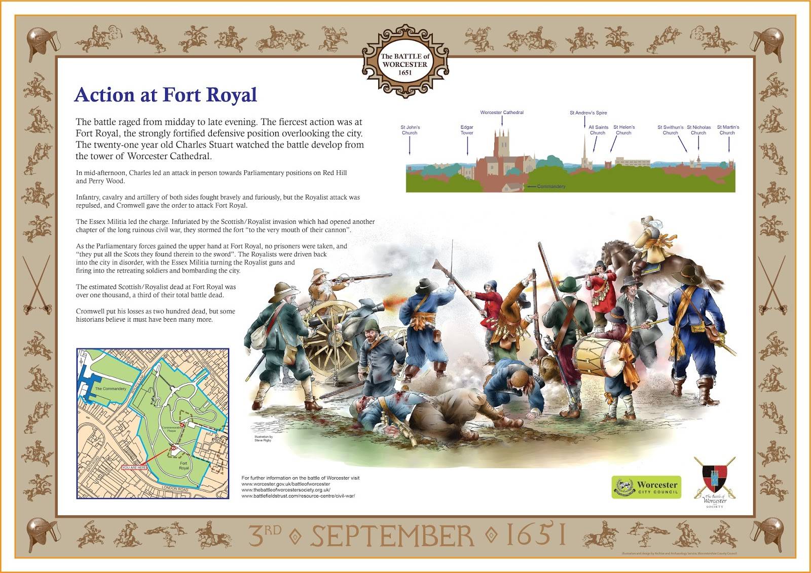
The Commandery is just outside the old city defences. It served as the command post for the forces on the east side of the city during the 1651 battle. It was here that the badly wounded Duke of Hamilton was brought. Nearby is the bridge over the canal (then the city ditch). The spot is marked by pikes on the parapet and an inscription to the right underneath. The fighting outside Sidbury Gate was intense and the Royalist casualties severe. Charles was nearly captured but the remnant of the Royalist cavalry made a charge down through Sidbury and forced the Parliamentary infantry back long enough for Charles to get back into the city.


Fort Royal Park is on a steep hill that gives panoramic views back towards the cathedral and also west towards the Malvern Hills. When the Royalists arrived in Worcester on 22nd August 1651 they started work on refortifying the city. The earthworks of the existing fort on Fort Royal Hill were reconstructed and cannon positioned to protect the city. Although the fort was in a strong position, the works were probably unfinished, and the defenders were no match for Cromwell’s superior numbers who swiftly overran it and turned the cannon onto the city. Over 100 years after the battle, in April 1786, two of the founding fathers of the new American state (John Adams and Thomas Jefferson, the future 2nd and 3rd Presidents) visited Fort Royal and are quoted as saying that this is ‘the ground where liberty was fought for’.
The Worcester and Birmingham Canal, opened in 1815, links the two cities, one a bastion of English history and tradition, the other a ‘new’ Victorian city at the very heart of the Industrial Revolution. It starts in Worcester, as an ‘offshoot’ of the River Severn (just after the river lock) and ends in Gas Street Basin in Birmingham (see our Birmingham walk). It is 47kms (29 miles) long. There are 58 locks in total, including the 30 Tardebigge Locks, one of the largest lock flights in Europe.
Diglis Basin Marina is a tranquil and agreeable spot that has in recent years been successfully re-developed with 450 waterfront apartments. It’s a good example of canalside regeneration, where old integrates with new. The canal basin plays host to an eclectic mix of water craft and a floating café.


Diglis Playing Fields has undergone a period of significant change, funded by ‘Section 106’ money paid for by private developers as a condition for planning permission for building on the area around the canal basin. The north end of the field is home to two football pitches, used on a regular basis throughout the season by the Worcester & District Football League, and a stone circle feature known locally as ‘the henge’. The southern end of the field is an informal open space used for kickabouts and events, and also a new play area opened in 2015 as part of the improvements scheme. This is a positive example of where the right type of re-development can enhance a location and add to the quality and amenity of nearby green space.
Next to the playground is a very special feature of the area, a miniature railway which has been in operation in Diglis since August 1954 and is still going strong today with public running days on the third Sunday afternoon (2.30-4.30pm) of the month between April and October.


Cherry Orchard Local Nature Reserve occupies a former landfill site which has remained undisturbed since 1987. A mosaic of habitats has emerged through natural colonisation. Flower rich grassland and scrub dominate, contributing to the green corridor that extends into the city from the south. It was designated a Local Nature Reserve in 2003.


The impressive and well-used Diglis Bridge, a new cable-stay bridge for pedestrians and cyclists, opened in 2010. The River Severn splits Worcester into two. Before this project there were only two places for pedestrians and cyclists to cross the river, one of which is shared with all of the traffic converging on the city’s only road bridge. By being located towards the south of the city centre, and connecting with new or improved paths alongside the river, a greenway loop has been created, right in the heart of the city. And the increased usage proves that people are happy to walk or bike where it is convenient and pleasant – in this case trips past this spot increased from 31,000 trips annually to 465,000 within a few years.
Heading back to the city centre, we passed by the striking King’s School Boathouse, designed to look like a rowing boat. The ground floor to the building is a boat storage area, with the upper level being a gym. The ground floor is designed to flood when the level of the River Severn is high. The project won the Midlands Regional RIBA Award in 2013. A piece of modern design that fits perfectly into its historic setting.


A sandstone structure with portcullis and double gates, The Water Gate entranceway afforded access directly to the River Severn from the cathedral and monastery grounds. It was built by William Poer, the cathedral cellerar, in 1378.


A ferry crossed the river at this point; the Priory ferry or Cathedral ferry as it was known worked regularly until the mid-twentieth century, although even today during the summer months at weekends and bank holidays the ferry still operates, manned by volunteers.
Historians and archaeologists believe there has been a river crossing at this location for up to 4,000 years, though the recorded history of the ferry only dates back to the 1300s when it was established to take monks, milkmaids and herdsmen across the river to the monastic meadows opposite the cathedral.
At South Quay we enjoyed watching kids running into the Millennium Fountain, trying to second guess the timing of the individual jets of water.


Looking up the slope from here we saw The Glovers Needle. This tower and spire is all that remains of St. Andrew’s Church. There has been a church on this site since the 12th century, but it was demolished during the final stages of the slum clearances in the area during the late 1940s, with only the spire as a reminder.
Worcester College of Technology, which has gown rapidly in the last few years, occupies several of the buildings here, with some notable architecture. One is the St Wulstan’s Building, which was completed in 1941 as a Police Station, designed by Sir Percy Thomas. If this could be described as an ‘average’ style of building, then it’s a very good average.


The Worcester Guildhall, the seat of local government, dates from 1721; it replaced an earlier hall on the same site. The Grade I listed Queen Anne style building is described by Pevsner as ‘a splendid town hall, as splendid as any of C18 England’.


The High St is a mix of crass modern fascia and architectural gems. Next gem is St Nicholas Church, on our right and then The Cross, another redundant 18th century church with an imposing spire, now part of a restaurant chain.


The Hop Market Hotel was built at the beginning of the 20th century, and extended when buildings were demolished to make the street wider. The name is still clearly visible on the stone facade of the building, even though it is no longer a hotel. An archway leads into the courtyard in the centre of the hotel, now occupied by an eclectic mix of shops.
In the times when there actually was a hop market, things could get very lively; the Worcester Advertiser reported in 1901 how hop merchants were mobbed, because the crop was too plentiful, and local producers were unhappy at the price they were being given: “The day of the great fair presented a scene of unprecedented disorder, which almost deserved to be called a riot.”
Finally, on the left, Berkeley Court is a group of Almshouses set around a courtyard, which can be seen through its wrought-iron gates. These particular Almshouses were founded by Robert Berkeley of Spetchley in 1692, and were built around 1705, on the site of a section of city wall (see the plaque).


Then we get a great view of the railway viaduct as we return to the station and pause for a bit of conceptual art before the actual train arrives.
WALK DATA
Distance: 7 kms (4.4 miles)
Height Change: 40 metres
Typical time: 1 ¾ hours
Start & Finish: Foregate St Station (WR1 1DB)
Terrain: pavement the whole way
THE ROUTE
- Turn left (N) out of the station and head up Foregate St to Castle St; before turning into it, continue up a few yards to look at the Kays & Co. building on your right
- Turn left into Castle St and walk down to Worcester Race Course (public access); continue along Croft Rd, bearing left, then cut left along a pedestrian route under the railway arch
- Pass the Hive on your left and then turn left into The Butts, heading NE until you reach Angel Place, where you turn right (S)
- Head S to Broad St, then take a right (E) along Broad St, crossing Foregate into St Swithin’s St and then kinking into Mealcheapen St
- On reaching the Cornmarket, turn right (S) down New St, until you reach Friar St
- Turn right into Pump St, left into the High St, and pass by the Elgar Statue at the bottom end; cross College St by the pedestrian crossing into College Yard and enter the north door of the cathedral
- Leave by the south door, through the Cathedral Cloisters into College Green; walk left through the Edgar Gate to the east (if the cathedral is closed, you can reach the College Green via the west end of the cathedral, where there is a path, down some steps)
- Turn right (S) and take the next left along King St (with the Museum of Royal Worcester on your right) into Sidbury; cross the canal and take the first left up Wyld’s Lane
- Shortly turn right (SE) up some steps into Fort Royal Park and head to the highest point to enjoy the incredible view; return to these steps and exit back to Wyld’s Lane, then back onto Sidbury
- Just before the canal bridge, turn right and join the canal (there is a gap in the fence); turn left (SW) along the canal and proceed to Diglis Basin Marina
- Turn left (SE) here, past the new marina on your right, cross Diglis Rd and enter the playing fields on the other side, called Diglis
- Keep to the right and you will see a metalled path at the far end on the right, that snakes round to the west past Cherry Orchard Nature Reserve and takes you to the river
- At the Diglis Bridge, turn right (N)and follow the east bank of the river all the way back past the cathedral, until you reach South Quay
- Bear right (E) here, with the St Andrew’s spire on your left, and go up Copenhagen St, across Deansway, to reach the Guildhall on your left
- Head up the High St and back to the station.
PIT STOPS
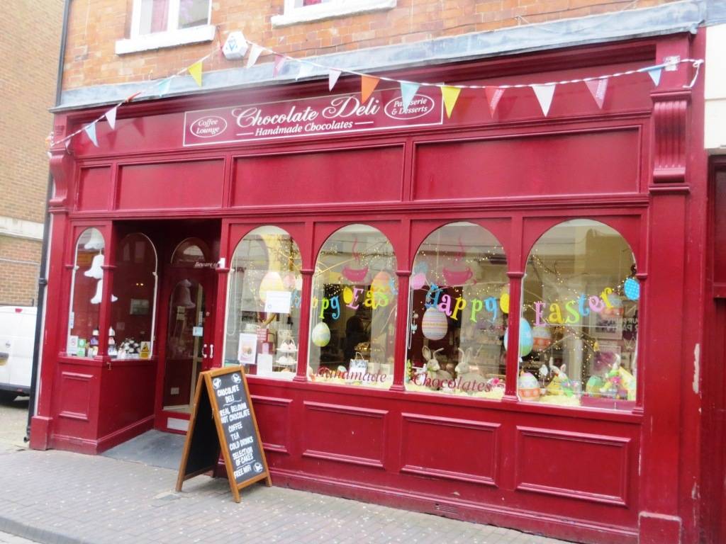
Chocolate Deli, 53 New Street, WR1 2DL (01905 611324 www.chocolatedeli.uk.com)
Floating Café, Diglis Basin (07715 271267) “The whole family loves this café. Perfect for snacks or lunch after a good walk along the river. Many thanks to everyone involved in this special barge.” (Trip Advisor)
QUIRKY SHOPPING
Hopmarket Hotel: a range of eclectic shops, including clothing.
New Street – so many good interesting shops in this street, including a music shop. Find out more at http://www.newstreetworcester.co.uk/
PLACES TO VISIT
Greyfriars, Friar St, Worcester WR1 2LZ ( 01905 23571 www.nationaltrust.org.uk/greyfriars-house-and-garden )
Greyfriars, Worcester, was a Franciscan friary and school in Worcester, England. It is a Grade I listed building.


Worcester Porcelain Museum, Severn Street, WR1 2ND (01905 21247 www.museumofroyalworcester.org
The Commandery, Sidbury, WR1 2HU (01905 361821 www.worcestershire.gov.uk/museums/info/1/the_commandery) Lots of interesting stuff on The Civil War.
Diglis Miniature Railway (http://worcestermodelengineers.blogspot.co.uk/2008/01/welcome-to-worcester-and-district-model.html ) still runs every third Sunday of the month from 2.30-4.30pm between April to October inclusive.
Worcester Guildhall, High St, WR1 2EY (01905 722018 www.worcester.gov.uk/guildhall)
Leave a Reply